Fichièr:Song Dynasty Map.JPG

Lo contengut de la pagina non es disponible dins una autra lenga.
Un article de Wikipèdia, l'enciclopèdia liura.

Fichièr d'origina(756 × 768 pixèl, talha del fichièr: 436 Ko, tipe MIME: image/jpeg)

Info

Descripcion

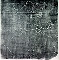
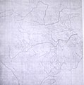
The Chinese Yu Ji Tu (Map of the Tracks of Yu the Great), a map carved into stone in the year 1137 during the Song Dynasty, located in the Stele Forest of modern-day Xian, China. Yu the Great refers to the Chinese deity described in the Chinese geographical work of the Yu Gong, a chapter of the Classic of History. Needham and Chavannes assert that the original map must have predated the 12th century.

The graduated scale of this gridded map is at 100 li (Chinese mile) squared for every representative square in the grid. The overall size of the map is 3 ft squared. The coastal outline is relatively firm and the precision of the network of river systems is incredibly accurate. The name of the geographers and cartographers who initially created the map are unknown. In the year 1142 a copy of the map was preserved at Zhenjiang in Jiangsu province by a certain Yu Chi, who was then a Prefectural Director of Studies. There is also mention of an earlier copy of about 1100 AD which itself was based on the Chang'an version. Needham asserts that the map was used primarily to instruct students while referring to sites described in the ancient Yu Gong chapter of the Classic of History.
Data printing of a rubbing of a c. 1136 engraving of a c. 1100 map
Font Joseph Needham's Science and Technology in China, Vol. 3: Mathematics and the Sciences of the Heavens and the Earth, Plate LXXXI and text description pp. 547–549, hardback edition
Autor Unknown, photo by PericlesofAthens


Public domain

Aquest material està en domini públic als Estats Units i als altres països on el dret d'autor s'estén per 70 anys (o menys) després de la mort de l'autor.


Cal incloure una etiqueta de domini públic als Estats Units per indicar perquè aquesta obra és en domini públic als Estats Units. Veuillez aussi noter que certains pays ont des droits d'auteurs qui courent plus de 70 ans après la mort : 75 ans pour les Samoa et le Guatemala, 80 ans pour la Colombie, 95 ans pour la Jamaïque, 100 ans pour le Mexique. Cette image peut ne pas être dans le domaine public dans ces pays, qui d'ailleurs n'appliquent pas la règle du terme le plus court.

Public domain Jo, el titular del copyright d'aquesta obra, l'allibero al domini públic. Això s'aplica a tot el món.
En alguns països això pot no ser legalment possible, en tal cas:
Jo faig concessió a tothom del dret d'usar aquesta obra per a qualsevol propòsit, sense cap condició llevat d'aquelles requerides per la llei.

Llegendes

Afegeix una explicació d'una línia del que representa aquest fitxer

Elements representats en aquest fitxer

subjècte representat

Istoric del fichièr

Clicar sus una data e una ora per veire lo fichièr tal coma èra a aqueste moment

Data e oraMiniaturaDimensionsUtilizaireComentari
actual3 agost de 2011 a 07.25Miniatura per la version del 3 agost de 2011 a 07.25756×768 (436 Ko)Dragonet~commonswikibetter quality
3 novembre de 2007 a 10.32Miniatura per la version del 3 novembre de 2007 a 10.32834×843 (89 Ko)PericlesofAthens{{Information |Description=The Chinese ''Yu Ji Tu'' (Map of the Tracks of Yu the Great), a map carved into stone in the year 1137 during the Song Dynasty, located in the Stele Forest of modern-day Xian, China. Yu the Great refers to the Chinese deity desc

Las paginas çaijós compòrtan aqueste imatge :

Usatge global del fichièr

Los autres wikis seguents utilizan aqueste imatge :

Metadonadas