
Fichièr:Spice Islands Tanzania-fr.svg

Talha d'aquesta previsualizacion PNG per aquest fichièr SVG: 486 × 599 pixèls. Autras resolucions : 195 × 240 pixèls | 389 × 480 pixèls | 623 × 768 pixèls | 831 × 1 024 pixèls | 1 661 × 2 048 pixèls | 713 × 879 pixèls.
Fichièr d'origina (Fichièr SVG, resolucion de 713 × 879 pixèls, talha : 24 Ko)
| Aqueste fichièr proven de Wikimedia Commons?. Las informacions que lo concernisson son afichadas çaijós (procedura). |
Descripcion
| Descripcion |
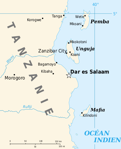
English: Part of the map of Tanzania in French, showing the Spice Islands. Français : Détail de la carte de Tanzanie en français montrant l'archipel de Zanzibar. |
| Data | of the translation : July 2007 |
| Font | Image:Spice Islands (Tanzania).svg created by Mysid |
| Autor | of the translation : Sting |
| Permission (Reütilizacion d'aqueste fichièr) |
PD |
| Autras versions |
Image:Spice_Islands-Zanzibar_highlighted-fr.svg in English : Image:Spice Islands (Tanzania).svg in English : Image:Spice Islands (Zanzibar highlighted).svg |
.svg)
.svg)

|
This SVG file contains embedded text that can be translated into your language, using any capable SVG editor, text editor or the SVG Translate tool. For more information see: About translating SVG files. |
Publicat jos licéncia(s)
| Jo, el titular del copyright d'aquesta obra, l'allibero al domini públic. Això s'aplica a tot el món. En alguns països això pot no ser legalment possible, en tal cas: Jo faig concessió a tothom del dret d'usar aquesta obra per a qualsevol propòsit, sense cap condició llevat d'aquelles requerides per la llei. |
| This work was previously under Public Domain, or a Free License. It has been digitally enhanced and/or modified. This derivative work has been (or is hereby) released into the public domain by its author, Sting at the French Wikipedia project. This applies worldwide. In some countries this is not legally possible; if so:
|
Istoric del fichièr
Clicar sus una data e una ora per veire lo fichièr tal coma èra a aqueste moment
| Data e ora | Miniatura | Dimensions | Utilizaire | Comentari | |
|---|---|---|---|---|---|
| actual | 18 setembre de 2010 a 15.07 | | 713×879 (24 Ko) | Uwe Dedering | Unguja + fonts |
| 6 julhet de 2007 a 13.24 |  | 713×879 (24 Ko) | Sting | {{Information |Description={{en|Part of the map of Tanzania in French, showing the Spice Islands.}}{{fr|Détail de la carte de Tanzanie en français montrant l'archipel de Zanzibar.}} |Source=[[: Image:Spice |
Paginas que contenon lo fichièr
La pagina çaijós compòrta aqueste imatge :
Usatge global del fichièr
Los autres wikis seguents utilizan aqueste imatge :
- Utilizacion sus avk.wikipedia.org
- Utilizacion sus de.wikipedia.org
- Utilizacion sus fr.wikipedia.org
- Utilizacion sus fr.wiktionary.org
- Utilizacion sus it.wikipedia.org
- Utilizacion sus la.wikipedia.org
- Utilizacion sus no.wikipedia.org
- Utilizacion sus pt.wikipedia.org