
Fichièr:Iceberg B-15A weather instrument.jpg
Talha d'aquesta previsualizacion: 800 × 525 pixèls. Autras resolucions : 320 × 210 pixèls | 640 × 420 pixèls | 1 024 × 672 pixèls | 1 280 × 840 pixèls | 2 000 × 1 312 pixèls.
Fichièr d'origina (2 000 × 1 312 pixèl, talha del fichièr: 1,02 Mo, tipe MIME: image/jpeg)
| Aqueste fichièr proven de Wikimedia Commons?. Las informacions que lo concernisson son afichadas çaijós (procedura). |
Descripcion
| Descripcion |
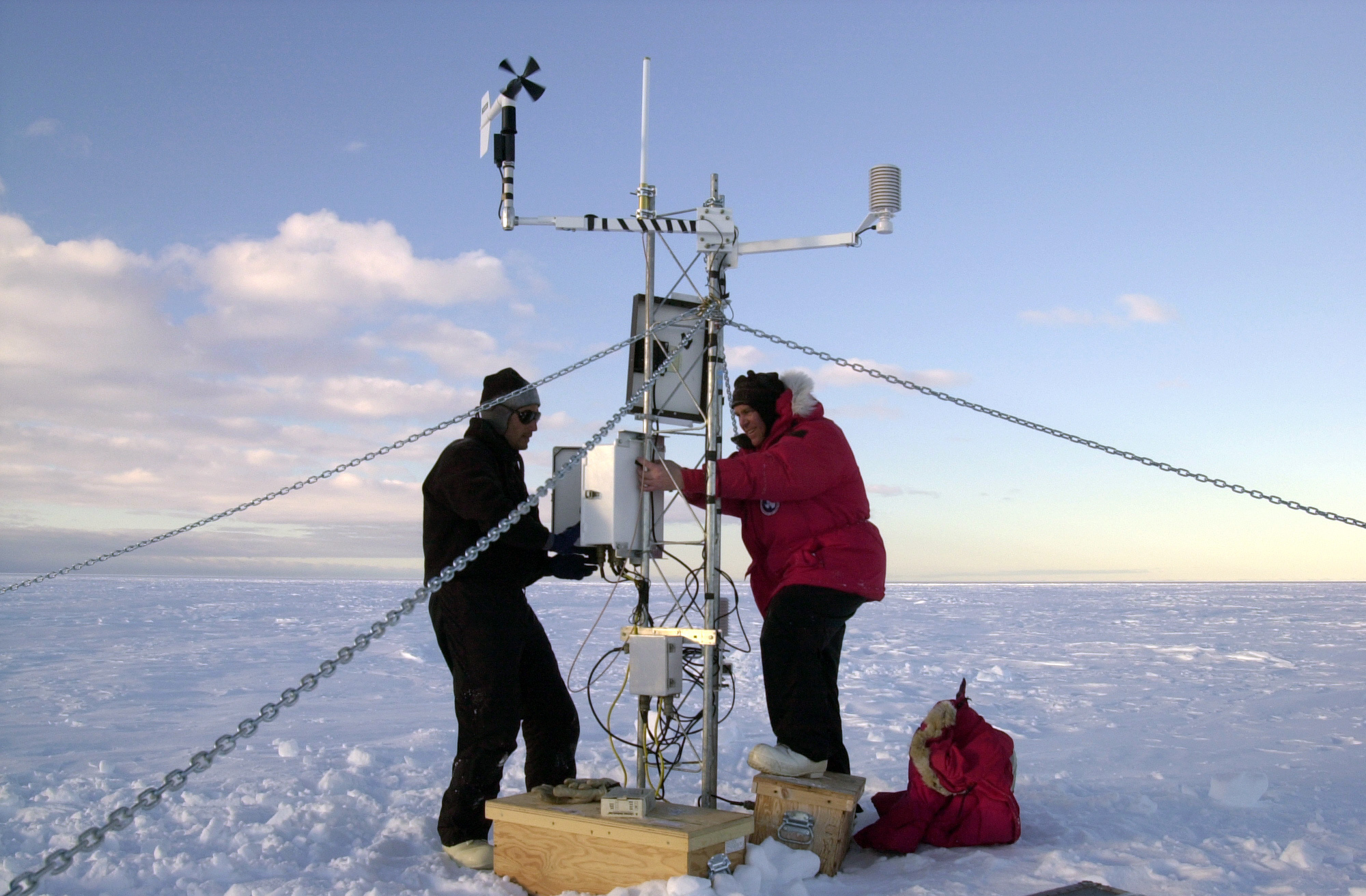
English: Researchers from the University of Chicago and the University of Wisconsin install weather and Global Positioning System instruments on Iceberg B-15A. It's the first time an iceberg has been monitored like this, and the data will allow an unprecedented understanding of how giant bergs make their way through the waters of Antarctica and beyond.
Français : Des chercheurs de Chicago University et Wisconsin University installent un GPS sur l'iceberg B-15A. |
| Data | |
| Font | Antarctic Photo Library, U.S. Antarctic Program |
| Autor | NSF/Josh Landis, employee 1999-2001 |
Publicat jos licéncia(s)
| This image is a work of a National Science Foundation employee, taken or made as part of that person's official duties. As a work of the U.S. federal government, the image is in the public domain. |  |
Istoric del fichièr
Clicar sus una data e una ora per veire lo fichièr tal coma èra a aqueste moment
| Data e ora | Miniatura | Dimensions | Utilizaire | Comentari | |
|---|---|---|---|---|---|
| actual | 19 febrièr de 2014 a 12.38 | | 2 000×1 312 (1,02 Mo) | Bede735 | Adjusted brightness and contrast |
| 21 març de 2007 a 02.56 |  | 2 000×1 312 (1 016 Ko) | Arria Belli | {{Information |Description= {{en|University of Chicago and the University of Wisconsin Antarctica researchers install weather and Global Positioning System instruments on iceberg B-15A.}} {{fr|Des chercheurs de Chicago University et Wisconsin Universi |
Paginas que contenon lo fichièr
I a ges de pagina que compòrta un ligam vèrs aqueste imatge.
Usatge global del fichièr
Los autres wikis seguents utilizan aqueste imatge :
- Utilizacion sus ast.wikipedia.org
- Utilizacion sus az.wikipedia.org
- Utilizacion sus ca.wikipedia.org
- Utilizacion sus en.wikipedia.org
- Utilizacion sus es.wikipedia.org
- Utilizacion sus eu.wikipedia.org
- Utilizacion sus fa.wikipedia.org
- Utilizacion sus fr.wikipedia.org
- Utilizacion sus hy.wikipedia.org
- Utilizacion sus it.wikipedia.org
- Utilizacion sus ja.wikipedia.org
- Utilizacion sus pt.wikipedia.org