
Fichièr:Africa-countries-northern.png
Pas de resolucion mai nauta de disponibla.
Africa-countries-northern.png (360 × 392 pixèl, talha del fichièr: 10 Ko, tipe MIME: image/png)
| Aqueste fichièr proven de Wikimedia Commons?. Las informacions que lo concernisson son afichadas çaijós (procedura). |

|
Una version vectoriala d'aqueste imatge existís, dins lo format "SVG".
Deuriá èsser utilizada a la plaça de la presenta version per d'afichatges en dimensions mai grandas o que necessitan una resolucion melhora. File:Africa-countries-northern.png → File:Africa-countries-northern.svg
Per mai d'entresenhas suls imatges vectorials, consultatz la pagina de transicion de Commons cap al format SVG. Vejatz tanben las entresenhas a prepaus del biais que lo logicial MediaWiki supòrta los imatges al format SVG. |
 |
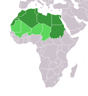
Descripcion
English: Map of countries in geo-political North Africa — as considered by the U.N.
- Credits
from en:Image:Africa-countries-northern.png

|
Avètz la permission de copiar, distribuir e modificar aqueste document segon los tèrmes de la Licéncia de documentacion liura GNU, version 1.2 o mai recenta publicada per la Free Software Foundation; sens seccions inalterablas, sens tèxte de primièra pagina de tempa e sens tèxte de darrièra pagina de tempa. Un exemplar de la licéncia es inclús dins la seccion intitulada GNU Free Documentation License. |
| Aqueste fichièr es jos licéncia Creative Commons licéncia generica atribucion-partiment a l'identic 3.0 | ||
| ||
| Aquest avís de llicència s'ha afegit a aquest fitxer d'acord amb l'actualització de la llicència GFDL. |
Istoric del fichièr
Clicar sus una data e una ora per veire lo fichièr tal coma èra a aqueste moment
| Data e ora | Miniatura | Dimensions | Utilizaire | Comentari | |
|---|---|---|---|---|---|
| actual | 17 març de 2018 a 15.22 | | 360×392 (10 Ko) | Maphobbyist | Montenegro border |
| 31 març de 2016 a 21.00 |  | 360×392 (10 Ko) | Fry1989 | Reverted to version as of 16:12, 13 January 2014 (UTC) | |
| 7 novembre de 2015 a 09.37 |  | 360×392 (10 Ko) | Hpyounes | correction | |
| 13 genièr de 2014 a 16.12 |  | 360×392 (10 Ko) | VVVF | See http://unstats.un.org/unsd/methods/m49/m49regin.htm | |
| 13 genièr de 2014 a 15.59 |  | 360×392 (13 Ko) | VVVF | Reverted to version as of 20:15, 9 July 2011. See http://unstats.un.org/unsd/methods/m49/m49regin.htm | |
| 20 julhet de 2011 a 12.47 |  | 360×392 (7 Ko) | Kahusi | See http://unstats.un.org/unsd/methods/m49/m49regin.htm | |
| 9 julhet de 2011 a 20.15 |  | 360×392 (13 Ko) | Maphobbyist | South Sudan has become independent on July 9, 2011. Sudan and South Sudan are shown with the new international border between them. | |
| 5 mai de 2006 a 11.13 |  | 360×392 (4 Ko) | Hautala | optimized with png | |
| 20 abril de 2005 a 16.30 |  | 360×392 (14 Ko) | Yonghokim | map of countries in Northern Africa. from en:Image:Africa-countries-northern.png {{GFDL}} |
Paginas que contenon lo fichièr
I a ges de pagina que compòrta un ligam vèrs aqueste imatge.
Usatge global del fichièr
Los autres wikis seguents utilizan aqueste imatge :
- Utilizacion sus ce.wikipedia.org
- Utilizacion sus es.wikipedia.org
- Utilizacion sus fr.wikipedia.org
- Utilizacion sus he.wikipedia.org
- Utilizacion sus ru.wikipedia.org
- Utilizacion sus sc.wikipedia.org
- Utilizacion sus sv.wikinews.org