
Fichièr:Habsburg Map 1547.jpg
Fichièr d'origina (1 654 × 1 029 pixèl, talha del fichièr: 534 Ko, tipe MIME: image/jpeg)
| Aqueste fichièr proven de Wikimedia Commons?. Las informacions que lo concernisson son afichadas çaijós (procedura). |
Descripcion
| Descripcion |
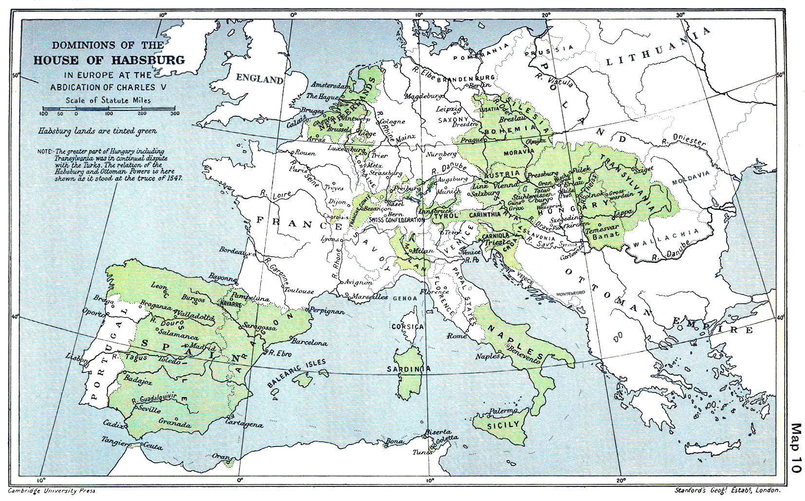
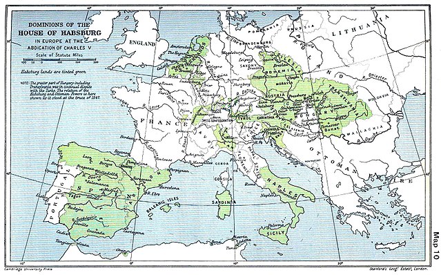
English: A map of the dominion of the Habsburgs following the Battle of Mühlberg (1547) |
| Data | |
| Font |
The Cambridge Modern History Atlas, edited by Sir Adolphus William Ward, G.W. Prothero, Sir Stanley Mordaunt Leathes, and E.A. Benians. Cambridge University Press: London, 1912. Editors were Sir Adolphus William Ward (†1924), G.W. Prothero (†1922), and Sir Stanley Mordaunt Leathes (†1938). Individual authors of works making up the atlas are not identified, nor are the likely to be, after reasonable research. |
| Autor | edited by Sir Adolphus William Ward, G.W. Prothero, Sir Stanley Mordaunt Leathes |
| Autras versions |
|

Publicat jos licéncia(s)
Cette œuvre est dans le domaine public aux États-Unis car elle a été publiée avant le 1er janvier 1929.
Les œuvres dans le domaine public doivent être inéligibles pour le droit d'auteur à la fois aux États-Unis et dans leur pays d'origine pour pouvoir être hébergées sur Commons. Si l'œuvre ne provient pas des États-Unis, le fichier doit comporter un bandeau de licence supplémentaire indiquant la situation vis-à-vis du droit d'auteur dans le pays d'origine.
|
This UK artistic or literary work, of which the author is unknown and cannot be ascertained by reasonable enquiry, is in the public domain because it is one of the following:
|
 |
Istoric del fichièr
Clicar sus una data e una ora per veire lo fichièr tal coma èra a aqueste moment
| Data e ora | Miniatura | Dimensions | Utilizaire | Comentari | |
|---|---|---|---|---|---|
| actual | 29 març de 2018 a 09.20 | | 1 654×1 029 (534 Ko) | Trecătorul răcit | Little add: borders of the time |
| 3 setembre de 2015 a 11.01 |  | 1 654×1 029 (518 Ko) | Kurzon | Reverted to version as of 17:22, 9 August 2010 | |
| 3 setembre de 2015 a 11.01 |  | 1 654×1 029 (518 Ko) | Kurzon | Reverted to version as of 17:22, 9 August 2010 | |
| 29 junh de 2013 a 21.33 |  | 1 654×1 029 (546 Ko) | CSvBibra | add more contrast per request by another user | |
| 9 agost de 2010 a 17.22 |  | 1 654×1 029 (518 Ko) | CSvBibra | Previously put cleaned up version in new file with "b" after name. Now updating original file with "b" version. Both files uses throughout Wikipedias | |
| 28 agost de 2008 a 09.07 |  | 1 654×1 029 (649 Ko) | F l a n k e r | Wrap, shadows and minor improvements | |
| 28 junh de 2005 a 14.42 |  | 1 654×1 029 (421 Ko) | Rythin~commonswiki | A map of the dominion of the Habsburgs following the Battle of Mühlberg (1547). Taken from ''The Cambridge Modern History Atlas,'' edited by Sir Adolphus William Ward, G.W. Prothero, Sir Stanley Mordaunt Leathes, and E.A. Benians. Cambridge University Pr |
Paginas que contenon lo fichièr
Las paginas çaijós compòrtan aqueste imatge :
Usatge global del fichièr
Los autres wikis seguents utilizan aqueste imatge :
- Utilizacion sus af.wikipedia.org
- Utilizacion sus an.wikipedia.org
- Utilizacion sus ar.wikipedia.org
- Utilizacion sus arz.wikipedia.org
- Utilizacion sus ast.wikipedia.org
- Utilizacion sus azb.wikipedia.org
- Utilizacion sus ba.wikipedia.org
- Utilizacion sus be.wikipedia.org
- Utilizacion sus bg.wikipedia.org
- Utilizacion sus br.wikipedia.org
- Utilizacion sus bs.wikipedia.org
- Utilizacion sus ca.wikipedia.org
- Utilizacion sus cs.wikipedia.org
- Utilizacion sus da.wikipedia.org
- Utilizacion sus de.wikipedia.org
- Utilizacion sus el.wikipedia.org
Veire l'utilizacion globala d'aqueste fichièr.