
Fichièr:Overijssel position.svg

Talha d'aquesta previsualizacion PNG per aquest fichièr SVG: 200 × 236 pixèls. Autras resolucions : 203 × 240 pixèls | 407 × 480 pixèls | 651 × 768 pixèls | 868 × 1 024 pixèls | 1 736 × 2 048 pixèls.
Fichièr d'origina (Fichièr SVG, resolucion de 200 × 236 pixèls, talha : 157 Ko)
| Aqueste fichièr proven de Wikimedia Commons?. Las informacions que lo concernisson son afichadas çaijós (procedura). |
Descripcion
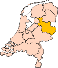
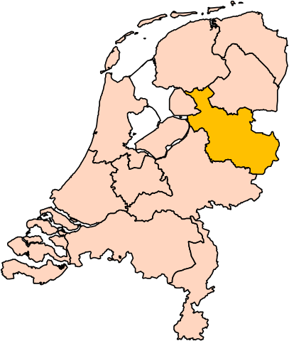
| Descripcion | Location of the province of Overijssel in the Netherlands. |
| Font | Trabalh personal |
| Autor | User:Mtcv |
| Permission (Reütilizacion d'aqueste fichièr) |
Data: attribution required; my work: PD |
| Autras versions | I attempted to make an svg version of Image:Overijssel-Position.png (with less simplified boundaries) |
Clickable version

Publicat jos licéncia(s)

|
Lo proprietari dels dreits d'autor d'aqueste fichièr, Centraal Bureau voor de Statistiek, autoriza a quina persona que siá de l'utilizar per quina intencion que siá, amb la condicion que lo titular dels dreits d'autor siá atribuít corrèctament. La redistribucion, la realizacion de trabalhs derivats, l'emplec comercial e autre tipe d'emplecs es permés. |
Atribucion:
|
| Annotations | This image is annotated: View the annotations at Commons |


Istoric del fichièr
Clicar sus una data e una ora per veire lo fichièr tal coma èra a aqueste moment
| Data e ora | Miniatura | Dimensions | Utilizaire | Comentari | |
|---|---|---|---|---|---|
| actual | 2 març de 2019 a 17.20 | | 200×236 (157 Ko) | Thayts | update |
| 3 octobre de 2006 a 00.44 |  | 200×236 (158 Ko) | Mtcv | {{Information| |Description=Location of the province of Noord-Holland (North Holland) in the Netherlands. |Source=Own work, based on freely available GIS data |Date=2006-10-03 |Author=User:Mtcv |Permission=Data: attribution required; my work: PD |othe |
Paginas que contenon lo fichièr
I a ges de pagina que compòrta un ligam vèrs aqueste imatge.
Usatge global del fichièr
Los autres wikis seguents utilizan aqueste imatge :
- Utilizacion sus ar.wikipedia.org
- أفريسل
- زفوله
- ديفينتر
- تفنتة
- قالب:بلديات أوفرآيسل
- هينجيلو
- ألميلو
- هاكسبيرخن
- بورنه (أوفرآيسل)
- أنسخديه
- قالب:مناطق أوفرآيسل
- دالفسن
- صلند
- دينكللاند
- هاردنبيرخ
- هيليندورن
- هوف فان تفنته
- كامبن (هولندا)
- كوب فان أوفرآيسل
- لوسر (هولندا)
- أولدنزال
- أولست- فايه
- أومين (هولندا)
- رالته
- رايسن- هولتن
- ستابهورست
- ستينفايكرلاند
- توبيرخن
- تفنتاراند
- فيردن (هولندا)
- زفارتافاترلاند
- Utilizacion sus be-tarask.wikipedia.org
- Utilizacion sus cy.wikipedia.org
- Utilizacion sus en.wikipedia.org
Veire l'utilizacion globala d'aqueste fichièr.