Fichièr:Hammurabi's Babylonia 1.svg
Lo contengut de la pagina non es disponible dins una autra lenga.
Un article de Wikipèdia, l'enciclopèdia liura.

Fichièr d'origina(Fichièr SVG, resolucion de 655 × 570 pixèls, talha : 183 Ko)

 
W3C-validity not checked.

Descripcion

Descripcion

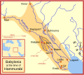
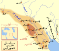
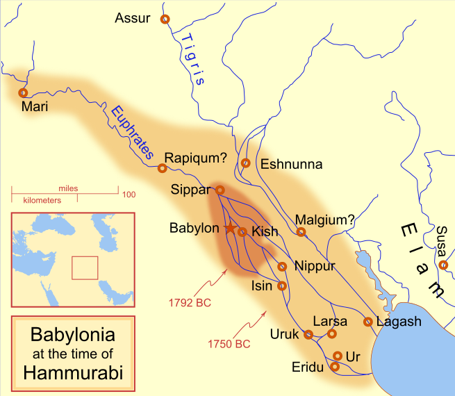
A locator map of Hammurabi's Babylonia, showing the Babylonian territory upon his ascension in 1792 BC and upon his death in 1750 BC. The river courses and coastline are those of that time period -- in general, they are not the modern rivers or coastlines. This is a Mercator projection, with north in its usual position

There is some question to what degree the cities of Nineveh, Tuttul, and Assur were under Babylonian authority. While in his introduction to his code of laws, Hammurabi claims lordship over these cities, Roaf does not include any of these in his map, upon which this map is based, and Chevalas states that "Assur and Nineveh were held for a very few years" (p. 155). Therefore, I have not included them as under Hammurabi's control in 1750 BC.
Data
Font Trabalh personal
Autor MapMaster
Autras versions

[modificar]

See also

References

  • Bjorklund, Oddvar; Holmboe, Haakon; Rohr, Anders (1970) Historical Atlas of the World, Barnes & Noble, NY, SBN: 389-00253-4.
  • Chavalas, Mark W.; K. Lawson Younger (2003) Mesopotamia and the Bible, Continuum International Publishing Group, ISBN 978-0567082312.
  • Hammond World Atlas Corporation (2007) Historical World Atlas, ISBN 9-780843-71391-6
  • Roaf, M. (1990) Cultural Atlas of Mesopotamia and the ancient Near East, Oxford: Facts on File. (In general, the basis for the ancient river courses and ancient coastline).
  • Van De Mieroop, Marc (2005). King Hammurabi of Babylon: A Biography. Blackwell Publishing. ISBN 1405126604

Publicat jos licéncia(s)

Ieu, autor d'aquesta òbra, publiqui jos las licéncias seguentas:
GNU head Avètz la permission de copiar, distribuir e modificar aqueste document segon los tèrmes de la Licéncia de documentacion liura GNU, version 1.2 o mai recenta publicada per la Free Software Foundation; sens seccions inalterablas, sens tèxte de primièra pagina de tempa e sens tèxte de darrièra pagina de tempa. Un exemplar de la licéncia es inclús dins la seccion intitulada GNU Free Documentation License.
w:oc:Creative Commons
atribucion partiment a l'identic
This file is licensed under the Creative Commons Attribution-Share Alike 4.0 International, 3.0 Unported, 2.5 Generic, 2.0 Generic and 1.0 Generic license.
Sètz liure :
  • de partejar – de copiar, distribuir e transmetre aquesta òbra
  • d'adaptar – d'adaptar aquesta òbra
Jos las condicions seguentas :
  • atribucion – Vos cal atribuir aquesta òbra amb lo biais especificat per l'autor o lo concedent (mas pas dins un sens que suggerís que vos apròvan o qu'apròvan l'utilizacion d'aquesta òbra).
  • partiment a l'identic – Se modificatz, transformatz, o vos basatz sus aquesta òbra, vos cal distribuir l'òbra resultanta jos la meteissa licéncia o una licéncia similara a aquesta.
Podètz causir la licéncia que volètz.

Llegendes

Afegeix una explicació d'una línia del que representa aquest fitxer
Babylonian

Elements representats en aquest fitxer

subjècte representat

image/svg+xml

Istoric del fichièr

Clicar sus una data e una ora per veire lo fichièr tal coma èra a aqueste moment

(Darrièras contribucions | Primièras contribucions) Veire (10 mai recentas) () (10 | 20 | 50 | 100 | 250 | 500).
Data e oraMiniaturaDimensionsUtilizaireComentari
actual21 abril de 2013 a 09.14Miniatura per la version del 21 abril de 2013 a 09.14655×570 (183 Ko)CitypeekCleanup of file. Valid SVG now.
27 abril de 2010 a 19.06Miniatura per la version del 27 abril de 2010 a 19.06655×570 (168 Ko)DieBucheremoved border
30 julhet de 2009 a 15.05Miniatura per la version del 30 julhet de 2009 a 15.05661×580 (317 Ko)Amit6Some nodes changed.
3 març de 2008 a 23.24Miniatura per la version del 3 març de 2008 a 23.24661×580 (163 Ko)MapMasterAdded city-state, moved Sippar, minor other changes based on recent Kassite map
23 febrièr de 2008 a 16.06Miniatura per la version del 23 febrièr de 2008 a 16.06661×580 (161 Ko)MapMasterAdded 1 city, added name for 1 city
21 febrièr de 2008 a 03.29Miniatura per la version del 21 febrièr de 2008 a 03.29661×580 (159 Ko)MapMaster"blurred" the territory outlines
20 febrièr de 2008 a 23.25Miniatura per la version del 20 febrièr de 2008 a 23.25661×580 (155 Ko)MapMasterChanges made based on info from ''Mesopotamia and the Bible''
19 febrièr de 2008 a 02.03Miniatura per la version del 19 febrièr de 2008 a 02.03663×580 (156 Ko)MapMasterFixed an error on my part
18 febrièr de 2008 a 21.12Miniatura per la version del 18 febrièr de 2008 a 21.12332×292 (156 Ko)MapMastersome minor edits
18 febrièr de 2008 a 19.19Miniatura per la version del 18 febrièr de 2008 a 19.19332×293 (154 Ko)MapMasterremoved unrenderable bmp
(Darrièras contribucions | Primièras contribucions) Veire (10 mai recentas) () (10 | 20 | 50 | 100 | 250 | 500).

La pagina çaijós compòrta aqueste imatge :

Usatge global del fichièr

Los autres wikis seguents utilizan aqueste imatge :

Veire l'utilizacion globala d'aqueste fichièr.

Metadonadas