
Fichièr:Bonne projection of world with grid.png
Pas de resolucion mai nauta de disponibla.
Bonne_projection_of_world_with_grid.png (295 × 275 pixèl, talha del fichièr: 69 Ko, tipe MIME: image/png)
| Aqueste fichièr proven de Wikimedia Commons?. Las informacions que lo concernisson son afichadas çaijós (procedura). |
Descripcion
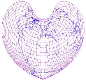
| Descripcion |
English: world map in Bonne projection with 10-degree grids, only in black lines on white background |
||
| Data | |||
| Font | drawn by myself; using freely available materials especially DCL found at http://www.gfd-dennou.org/arch/dcl | ||
| Autor | prasinos | ||
| Permission (Reütilizacion d'aqueste fichièr) |
public domain | ||
| Autras versions |
|

Publicat jos licéncia(s)
| Jo, el titular del copyright d'aquesta obra, l'allibero al domini públic. Això s'aplica a tot el món. En alguns països això pot no ser legalment possible, en tal cas: Jo faig concessió a tothom del dret d'usar aquesta obra per a qualsevol propòsit, sense cap condició llevat d'aquelles requerides per la llei. |
Istoric del fichièr
Clicar sus una data e una ora per veire lo fichièr tal coma èra a aqueste moment
| Data e ora | Miniatura | Dimensions | Utilizaire | Comentari | |
|---|---|---|---|---|---|
| actual | 14 octobre de 2007 a 19.00 | | 295×275 (69 Ko) | Prasinos | {{Information |Description=world map in Bonne projection with 10-degree grids, blue continents and purple grauticle on white background |Source=drawn by myself with program http://apollo.ersc.wisc.edu/finch/zz2007/cartoplus/dcl-projfigs.shar using freely |
| 30 setembre de 2007 a 20.14 |  | 295×275 (28 Ko) | Prasinos | {{Information |Description=world map in Bonne projection with 10-degree grids, only in black lines on white background |Source=drawn by myself; using freely available materials especially DCL found at http://www.gfd-dennou.org/arch/dcl |Date=2007-10-01 |A |
Paginas que contenon lo fichièr
Las paginas çaijós compòrtan aqueste imatge :
Usatge global del fichièr
Los autres wikis seguents utilizan aqueste imatge :
- Utilizacion sus fr.wikipedia.org
- Utilizacion sus pt.wikipedia.org