Fichièr:150132main image feature 589 alaska.jpg

Talha d'aquesta previsualizacion: 763 × 600 pixèls. Autras resolucions : 306 × 240 pixèls | 611 × 480 pixèls | 978 × 768 pixèls | 1 280 × 1 006 pixèls | 2 560 × 2 011 pixèls | 5 600 × 4 400 pixèls.
Fichièr d'origina (5 600 × 4 400 pixèl, talha del fichièr: 6,63 Mo, tipe MIME: image/jpeg)
Istoric del fichièr
Clicar sus una data e una ora per veire lo fichièr tal coma èra a aqueste moment
| Data e ora | Miniatura | Dimensions | Utilizaire | Comentari | |
|---|---|---|---|---|---|
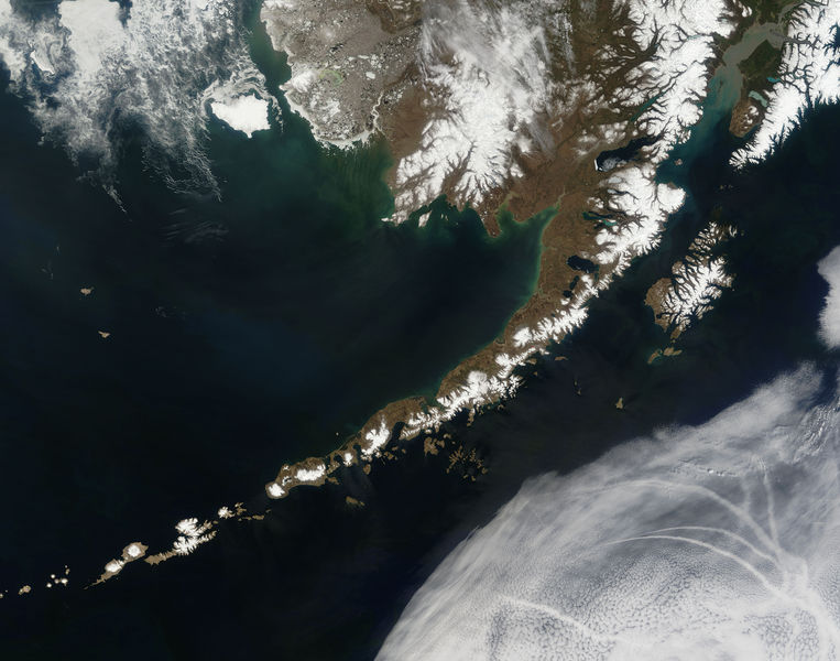
| actual | 14 julhet de 2006 a 19.55 |  | 5 600×4 400 (6,63 Mo) | Felipe Menegaz | {{Information| |Description= The Aleutian Islands and the Alaskan peninsula are shown in this image acquired by the MODIS on the Terra satellite, on May 25th, 2006. The Aleutians are a chain of more than 300 small volcanic islands forming an island arc in |
Paginas que contenon lo fichièr
La pagina çaijós compòrta aqueste imatge :
Usatge global del fichièr
Los autres wikis seguents utilizan aqueste imatge :
- Utilizacion sus af.wikipedia.org
- Utilizacion sus als.wikipedia.org
- Utilizacion sus bn.wikipedia.org
- Utilizacion sus ca.wikipedia.org
- Utilizacion sus cs.wikipedia.org
- Utilizacion sus de.wikipedia.org
- Utilizacion sus eo.wikipedia.org
- Utilizacion sus es.wikipedia.org
- Utilizacion sus fr.wikipedia.org
- Utilizacion sus gl.wikipedia.org
- Utilizacion sus hu.wikipedia.org
- Utilizacion sus ia.wikipedia.org
- Utilizacion sus it.wikipedia.org
- Utilizacion sus ja.wikipedia.org
- Utilizacion sus ko.wikipedia.org
- Utilizacion sus os.wikipedia.org
- Utilizacion sus pl.wikipedia.org
- Utilizacion sus pl.wiktionary.org
- Utilizacion sus pt.wikipedia.org
- Utilizacion sus ro.wikipedia.org
- Utilizacion sus ru.wikipedia.org
- Utilizacion sus ru.wikinews.org
- Utilizacion sus sah.wikipedia.org
- Utilizacion sus sk.wikipedia.org
- Utilizacion sus sr.wikipedia.org
- Utilizacion sus sv.wikipedia.org
- Utilizacion sus tr.wikipedia.org


