
Fichièr:Balkans-political-map-small.png
Pas de resolucion mai nauta de disponibla.
Balkans-political-map-small.png (507 × 488 pixèl, talha del fichièr: 12 Ko, tipe MIME: image/png)
| Aqueste fichièr proven de Wikimedia Commons?. Las informacions que lo concernisson son afichadas çaijós (procedura). |
Descripcion

|
This file requires updating. Please see the talk page for more information. In doing so, you could add a timestamp to the file.
|
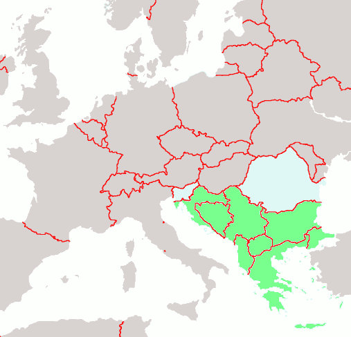
Political map of the Balkans
map of Europe by Brion VIBBER: the Balkans are highlighted in green
| Jo, el titular del copyright d'aquesta obra, l'allibero al domini públic. Això s'aplica a tot el món. En alguns països això pot no ser legalment possible, en tal cas: Jo faig concessió a tothom del dret d'usar aquesta obra per a qualsevol propòsit, sense cap condició llevat d'aquelles requerides per la llei. |
en:Balkans-political-map-small.png
Istoric del fichièr
Clicar sus una data e una ora per veire lo fichièr tal coma èra a aqueste moment
| Data e ora | Miniatura | Dimensions | Utilizaire | Comentari | |
|---|---|---|---|---|---|
| actual | 29 novembre de 2004 a 22.18 | | 507×488 (12 Ko) | Mschlindwein | Political map of the Balkans |
Paginas que contenon lo fichièr
La pagina çaijós compòrta aqueste imatge :
Usatge global del fichièr
Los autres wikis seguents utilizan aqueste imatge :
- Utilizacion sus arz.wikipedia.org
- Utilizacion sus as.wikipedia.org
- Utilizacion sus bat-smg.wikipedia.org
- Utilizacion sus bn.wikipedia.org
- Utilizacion sus bs.wikipedia.org
- Utilizacion sus ckb.wikipedia.org
- Utilizacion sus cs.wikipedia.org
- Utilizacion sus de.wikipedia.org
- Utilizacion sus el.wikipedia.org
- Utilizacion sus en.wikipedia.org
- Utilizacion sus eo.wikipedia.org
- Utilizacion sus it.wikipedia.org
- Utilizacion sus ja.wikipedia.org
- Utilizacion sus jv.wikipedia.org
- Utilizacion sus ku.wiktionary.org
- Utilizacion sus lad.wikipedia.org
- Utilizacion sus li.wikipedia.org
- Utilizacion sus lmo.wikipedia.org
- Utilizacion sus lt.wikipedia.org
- Utilizacion sus mzn.wikipedia.org
- Utilizacion sus nl.wikipedia.org
- Utilizacion sus pl.wiktionary.org
- Utilizacion sus sh.wikipedia.org
- Utilizacion sus sr.wikinews.org